Day 6 – 🎶 Over the forest and through the woods 🎶

June 23, 2018
Day 6 – John Day to Baker City, OR – 81 miles, 5,075 feet vertical climb

My momma told me there’d be days like this. Actually, no, she didn’t, but that’s what I was thinking as I sat down for breakfast on the hard wooden chair and pondered my aching butt. Today’s ride profile had three climbs, all to mountain passes at elevations over 5,000 feet.

I warned Randy that I didn’t expect the hammer train to wait for me today, and he quickly agreed (although maybe just a little TOO quickly.) Anyway, we started off nice and steady and rode together in a paceline for the first ten miles.

I was behind Randy when he held up two fingers and called out to everyone, “Two minutes!” I yelled up to him, “What happens in two minutes?” He said, “That’s when the guns come out.”  <sigh>  Well, it was nice while it lasted.

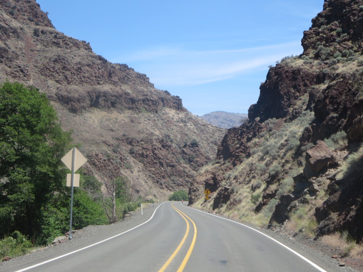
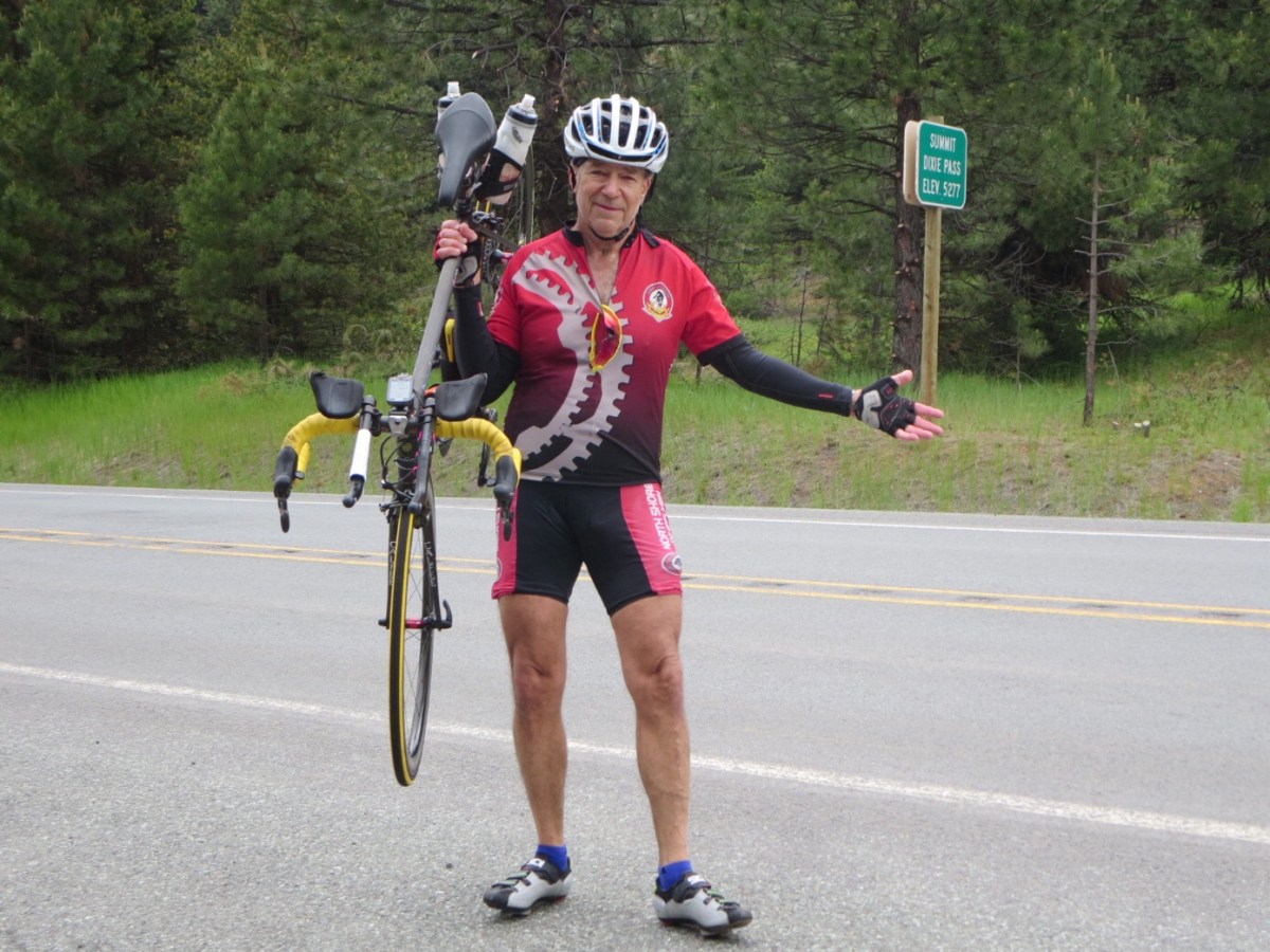
At the start of the first climb, I quickly realized that I had left my climbing legs back at the hotel and it was too late to go back and retrieve them. So, I took it slow and chit chatted with new folks and took lots of pictures. We climbed up to the summit of Dixie Mt. at 5,277’, Tipton Mt. at 5,124’ and Snall Summit at ~5,100’.

We were still in National Forest country with tall pines and amazing scenery. But the first descent from Dixie Mt. was C-O-L-D and as much as I was sweating like a pig going up the climb, I was freezing going down. Where were the throngs of French spectators handing out copies of Le Monde to stuff down our shirts for protection? The cold air came shooting through the vents in my helmet like icy spears and my fingers lost circulation (I have Reynaud’s). The long fingered gloves I brought along were safe and warm in my luggage.

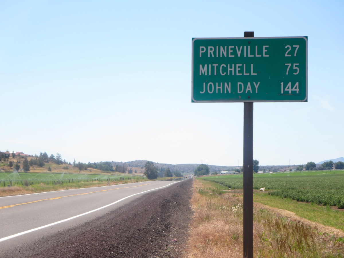
The good news was that we regrouped at the first SAG stop and got all the climbing out of the way after 50 miles. So it was downhill or flat the rest of the way … EXCEPT – for the final 10-mile stretch that was completely out in the open with a brutal headwind. Yeeesh.

Click on the first picture below for an annotated slide show and don’t forget to click on “Where’s Jeff” at jeffblye.com

Day 5 – Survivor. Bicycle edition.

June 22, 2018
Day 5 – Prineville to John Day, OR – 116 miles, 6,080 feet vertical

Well, we got it done. And now that it’s over, we can all breathe easier.

So we executed to plan and the “hammer” team left the hotel a little after 6:30am. It was a crisp clear morning and I joined the paceline with Randy, Rich, Tami, Jay and Garry. We all agreed to keep the pace reasonable and not to drop anyone. This policy was mostly directed at me and I warned everyone that I might get dropped on the climbs. “No, today is a ‘no drop’ day. We’ll wait for you,” said both Randy and Rich.

Well, I felt the love on the first climb as everyone kept looking out for me. “Jeff, you ok?” “Pull it back a little and let Jeff catch up.” And … so on. Truth be told, I can hold my own on the flats, but I’m no climber. “Just like André Greipel,” said Rich. (Greipel is a world class sprinter who can blow people away on the flats but has to haul his frame up and over the mountains in the Tour de France.). I thought this was way too complimentary, but as with any nickname that is repeated often enough, it sticks even if not true. So, now I’m André. Anyway, we stayed together for the better part of 75 miles and then I rode solo the rest of the trip.

And a most beautiful trip it was. We biked over two mountain passes: the Ochoco Pass at 4,720 feet and Keyes Creek Summit at 4,369 feet. We flew down from the Ochoco Pass and just wanted more. The trip through the canyons was spectacular and even the long gradual climb up to John Day was beautiful. I finished at 3:15 with a little over 7 hours of actual riding time.

At the Best Western, I sat in the hot tub for awhile and soaked my aching muscles and finished off the renewal with a few laps in the pool. Ah, feeling human again. It’s another tough day tomorrow with three big climbs.

Click on the first photo below for an annotated slide show and don’t forget to click on “Where’s Jeff” at jeffblye.com


Day 4 – The calm before the storm

June 21, 2018
Day 4 – Kah-Nee-Ta to Prineville, OR – 60 miles, 3,490 feet vertical

It was a dark and stormy night with thunderbolts and lightning, very very frightening (me, Galileo). But seriously, I was awakened several times with window rattling thunder claps, lightening and rain. I thought our luck with the weather had come to an end.

But somehow, the skies started to clear with the rising sun and with the start slightly delayed until 8am, we were able to set out without our rain gear. In fact, after the sun burned off the last remnants of the storm, the roads dried out and we had another beautiful day of riding. Lots of sunscreen.

Today was a relatively easy-peasy ride of only 60 miles. This gave us a chance to ride easy, socialize with new friends and take lots of pictures.

The real story, of course, is tomorrow – known officially as Day 5, but feared by all: our first killer day of 116 miles with 6,050 feet of vertical climb. We’re continuing east on US 26 to John Day. Oddly enough, the cue sheet is very short: make a left out of the parking lot and continue straight for 116 miles. (I really kid you not.)

Ok, the pity party is over, and I have to get some sleep.  Click on the first picture below for an annotated slide show.  Tomorrow’s post may be delayed.


Day 3 – Another beautiful day in the neighborhood

June 20, 2018
Day 3 – Welches to Kah-Nee-Ta, OR – 66 miles, 4,900 feet vertical

Got a slow start this morning. After yesterday’s frenetic pace, I was a little burned out and didn’t get a lot of sleep. Have to listen to the body and remember to take this ride one day at a time and to pace myself. And so, … I was almost the last one out of the parking lot after breakfast.

Today started out on the Mt. Hood Scenic Byway with a long climb of over 12 miles to 4000 feet elevation. The only good news was that it never got really steep and most of it was a grind at 4-6%. I took it slow and was reminded that in this direction (up), gravity is not my friend. Had a welcome SAG stop at the summit. After a thrilling downhill, we climbed again to summit through Blue Box Pass.

The second half of the ride took us out of the cool pine-covered mountains and into the high desert with scrub pines and hot baking sun. It’s amazing how quickly the terrain and scenery can change. Even though the ride was relatively short, the heat turned the last twenty miles into a tough slog. We were rewarded with an exhilarating downhill into Kah-Nee-Ta and exotic rock formations.

The Kah-Nee-Ta resort was set high on a hill and gave us one last kick in teeth with a 10% grade for .6 miles. I was pretty beat and collapsed diagonally on the comfy king-size bed. I took a nap for an hour and then went down to the pool to do some laps. There’s a free shuttle to the casino here, … but, um, … no thanks. Going to bed early tonight!

Click on the first photo below for an annotated slide show and don’t forget to click on “Where’s Jeff” at jeffblye.com


Day 2 – Moregon (that’s short for more of Oregon)

June 19, 2018
Day 2 – Saint Helens to Welches, OR – 75 miles, 3,060 feet vertical.

The sun was shining as we left our hotel and banged out a fast 22 miles in about an hour, thanks to my 5-cylinder engine of Randy, Rich, Tami and Jay. It was a great paceline to “get ‘er done”, as Tami would say. I can safely say that for probably the only time on this journey, I was the first to sign in at SAG 1 checkpoint (although all five of us arrived together.)

We continued to bang out the miles during the middle section until I got dropped around 55 miles when the gradient tilted up. Unfortunately, I ran over some glass and got two flats at about the 60-mile mark. That’s right, not one, but two. Very deflating!

We finished with a long climb and a magnificent view of Mt. Hood. We capped the day off by relaxing poolside at the Resort on the Mountain. Huge bonus: a nice piano at the bar. So I grabbed John (from Australia), who has been writing a song about our trip, and set it to music. Last piano for the next 3,000 miles!

You can follow my journal at jeffblye.com and click on “Where’s Jeff?” to see a cool


map.  Click on the photos for an annotated slide show on the day’s ride.